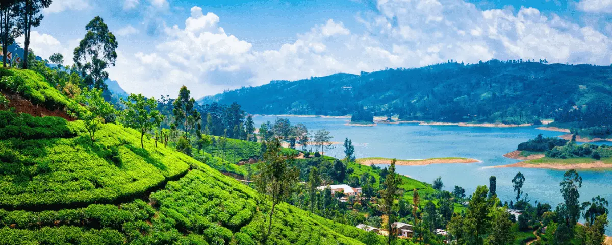
Sri Lanka has always been a country best experienced slowly. Away from the beaches, ancient cities and busy tourist centres, the island’s Central Highlands reveal another side of the country: misty mountains, tea-covered slopes, forest paths, remote villages and small communities living among some of Sri Lanka’s most beautiful landscapes.
The Pekoe Trail Sri Lanka is designed to experience this landscape on foot.
Stretching for around 300 kilometres through the Central Highlands and divided into 22 stages, the Pekoe Trail connects tea country, hill towns, forests, villages and historic landscapes. You do not need to walk the entire route. Individual stages can be combined with a holiday in places such as Kandy, Nuwara Eliya, Haputale and Ella.
The result is less like a conventional sightseeing excursion and more like a journey through the living landscape of Sri Lanka.
Important: Trail conditions can change because of rain, landslides, vegetation growth and other local factors. Check the latest official Pekoe Trail status and TrailWatch information before setting out. The information in this guide reflects available official information as of September 2026. (thepekoetrail.org)
What Is the Pekoe Trail?
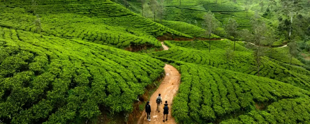
The Pekoe Trail is Sri Lanka’s first major long-distance walking trail. It runs through the Central Highlands, crossing landscapes shaped by tea cultivation, forests, agriculture and rural communities.
The official trail consists of 22 stages covering roughly 300 kilometres. Rather than being one continuous wilderness trek, the route links a series of existing paths, estate roads, village roads and historic routes. Walkers can therefore experience very different environments from one stage to another. (thepekoetrail.org)
The trail was developed as a way of opening up Sri Lanka’s tea country to slower, more sustainable forms of tourism. Along the route, hikers encounter tea estates, villages, viewpoints, forests, historic locations and communities whose lives are closely connected to the highlands.
This is one of the things that makes the Pekoe Trail particularly interesting. You are not simply walking through scenery; you are moving through a working cultural landscape.
Where Is the Pekoe Trail?
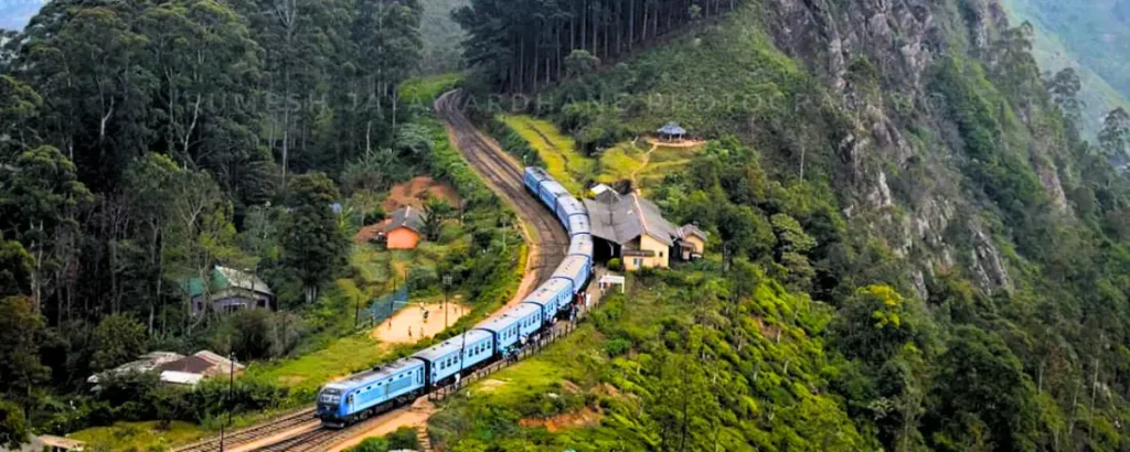
The Pekoe Trail crosses Sri Lanka’s Central Highlands, broadly linking the Kandy area with the tea-growing landscapes around Nuwara Eliya and continuing through the highlands towards the Ella and Uva region before reaching its final stages around Nuwara Eliya.
The route passes through or near destinations including:
- Kandy
- Galaha
- Loolkandura
- Pundaluoya
- Watagoda
- Kotagala
- Norwood
- Bogawantalawa
- Dayagama
- Horton Plains
- Haputale
- St Catherine’s
- Makulella
- Ella
- Demodara
- Hali Ela
- Ettampitiya
- Loonuwatte
- Uda Pussellawa
- Kandapola
- Pedro Estate near Nuwara Eliya
The route’s geography is one of its greatest strengths. You can combine hiking with Sri Lanka’s famous hill-country railway journeys, tea experiences and stays in mountain towns.
How Long Is the Pekoe Trail?
The Pekoe Trail is approximately 300 kilometres long and divided into 22 stages.
The individual stages vary considerably. Some are less than 10 kilometres, while others exceed 20 kilometres. Official estimated walking times range from around three hours to six hours, although actual times depend on fitness, weather, terrain, navigation and stops. (thepekoetrail.org)
This means you should not think of the Pekoe Trail as an all-or-nothing trek.
A traveller visiting Sri Lanka for two weeks might walk one or two stages. A dedicated hiker could plan a longer multi-stage journey. Another traveller might simply choose a scenic section around Ella or the tea country near Nuwara Eliya.
That flexibility is one of the trail’s biggest advantages.
The Pekoe Trail Stages
The official 22 stages are:
| Stage | Route | Approx. distance | Official difficulty |
|---|---|---|---|
| 1 | Hanthana – Galaha | 12.84 km | Easy |
| 2 | Galaha – Loolkandura | 14.70 km | Difficult |
| 3 | Loolkandura – Tawalantenne | 18.11 km | Difficult |
| 4 | Tawalantenne – Pundaluoya | 15.53 km | Difficult |
| 5 | Pundaluoya – Watagoda | 14.31 km | Moderate |
| 6 | Watagoda – Kotagala | 14.97 km | Easy |
| 7 | Kotagala – Norwood | 16.48 km | Moderate |
| 8 | Norwood – Bogawantalawa | 15.93 km | Moderate |
| 9 | Bogawantalawa – Dayagama | 17.13 km | Hard |
| 10 | Dayagama – Horton Plains | 15.88 km | Difficult |
| 11 | Horton Plains – Udaweriya | 14.30 km | Moderate |
| 12 | Udaweriya – Haputale | 19.68 km | Difficult |
| 13 | Haputale – St Catherine’s | 14.60 km | Hard |
| 14 | St Catherine’s – Makulella | 9.36 km | Moderate |
| 15 | Makulella – Ella | 9.61 km | Moderate |
| 16 | Ella – Demodara | 9.50 km | Easy |
| 17 | Demodara – Hali Ela | 13.15 km | Moderate |
| 18 | Hali Ela – Ettampitiya | 14.68 km | Hard |
| 19 | Ettampitiya – Loonuwatte | 21 km | Difficult |
| 20 | Loonuwatte – Uda Pussellawa | 13.63 km | Moderate |
| 21 | Uda Pussellawa – Kandapola | 16.90 km | Difficult |
| 22 | Kandapola – Pedro | 11.30 km | Moderate |
Distances and official difficulty classifications are based on the Pekoe Trail Organisation’s current stage information. (thepekoetrail.org)
A note about trail conditions
The table above describes the official route rather than guaranteeing that every section is currently open under normal conditions.
For example, in September 2026, Stage 3 was open under a Yellow Advisory, with overgrown sections around Stellenberg Pass and areas affected by the November 2025 cyclone. The Pekoe Trail Organisation recommends that hikers check TrailWatch, carry sufficient water, start early and avoid solo hiking on this stage. (thepekoetrail.org)
Stage 2 also currently has an amber section between Delthota and the Hulan Ella Gala area because of previous landslide damage. The official advice is for advanced hikers only, in dry conditions, with group hiking recommended. (thepekoetrail.org)
Always check the current status rather than relying on an old blog post or social media recommendation.
The Best Pekoe Trail Stages for Different Travellers
There is no single “best” stage. The right section depends on what you want from your hike.
Best for first-time hikers
Stage 1: Hanthana to Galaha is an attractive introduction. It begins at the Ceylon Tea Museum and travels through the Hanthana tea landscape towards Galaha. The official classification is Easy, making it one of the more approachable introductions to the trail. (thepekoetrail.org)
However, current conditions should always be checked before walking.
Best for tea-country scenery
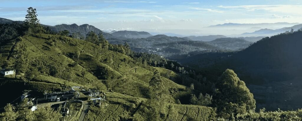
The stages around the Kandy, Hatton and Nuwara Eliya areas are particularly appealing to travellers who want to understand Sri Lanka’s tea landscape.
You will encounter estate roads, tea fields, plantation communities and mountain scenery rather than simply looking at tea plantations from a roadside viewpoint.
Best around Ella
Stages 14–17 offer a particularly convenient way to combine hiking with a stay in Ella.
Stage 15 connects Makulella and Ella, while Stage 16 links Ella with Demodara. The latter is officially classified as Easy and passes through the Ella Forest Reserve towards the famous Nine Arches Bridge. (thepekoetrail.org)
For travellers already visiting Ella, these stages can be an excellent way to go beyond the town’s most familiar attractions.
Best for experienced hikers
The longer and more demanding stages are better suited to hikers who are comfortable with significant elevation changes, variable surfaces and changing weather.
Stages 2, 3, 4, 9, 10, 12, 13, 18, 19 and 21 carry official Hard or Difficult classifications.
Do not judge difficulty from distance alone. A shorter stage with steep climbs, poor weather or difficult trail conditions can be more demanding than a longer walk on a gentle estate road.
How Difficult Is the Pekoe Trail?
The Pekoe Trail is not one single level of difficulty.
Its 22 stages range from Easy to Hard and Difficult. Some involve relatively gentle walking through tea estates, while others include substantial climbs and remote forest sections. (thepekoetrail.org)
Expect a mixture of:
- Estate roads
- Village roads
- Forest paths
- Grass and vegetation
- Mountain tracks
- Steep climbs and descents
- Uneven surfaces
- Wet or muddy sections after rain
Fitness is important, but so is preparation.
If you are a casual traveller, choose one of the easier stages rather than attempting to complete several demanding stages consecutively.
If you are an experienced hiker, you will have far more flexibility, but should still respect current advisories.
What Can You See Along the Pekoe Trail?
The attraction of the Pekoe Trail is its variety.
Tea plantations and estates
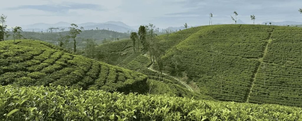
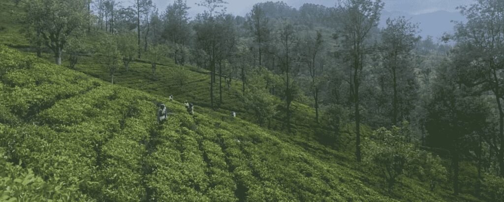
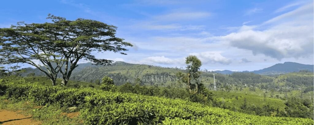
Tea is perhaps the defining landscape of the Central Highlands. Walking through tea estates provides a different perspective from viewing them from a car or train window.
You can see how plantations fit into the surrounding hills and communities and, depending on the route, encounter tea factories and estate settlements.
Forest and mountain landscapes
Several stages move away from cultivated tea landscapes and into forests and more remote terrain.
Stage 3, for example, enters the Piduruthalagala Conservation Forest and follows part of an old route known as the Dimbula Road, historically used by horses and bullock carts. (thepekoetrail.org)
Villages and local life
One of the most rewarding aspects of the trail is the transition between estate country and villages.
Stage 18, for example, passes through paddy cultivation, homes, temples, tea estates and small roads around Hali Ela and Ettampitiya. (thepekoetrail.org)
Railway landscapes
The Central Highlands’ railway is an important part of the region’s history and scenery. Several Pekoe Trail stages pass close to railway towns or stations, making it possible to combine hiking and train travel.
Waterfalls and viewpoints
Depending on the stage, walkers can encounter waterfalls, mountain viewpoints and dramatic valleys.
The important point is not to treat wildlife or specific natural phenomena as guaranteed. Conditions, visibility and seasonal changes can transform the experience.
Best Time to Hike the Pekoe Trail
There is no single perfect month for every part of the Pekoe Trail.
Sri Lanka’s Central Highlands have their own microclimates, and conditions can vary significantly between Kandy, Horton Plains, Haputale, Ella and Nuwara Eliya.
The Pekoe Trail Organisation currently notes December to April and July to September as generally favourable periods for much of the trail, while also stressing that weather varies by region. (thepekoetrail.org)
For hikers, the most important consideration is not simply the calendar. Check the local forecast and trail status immediately before walking.
Rain can result in:
- Muddy paths
- Slippery rocks
- Reduced visibility
- Swollen streams
- Leeches
- Landslide risk
- Changes to access
The trail organisation’s current safety updates demonstrate why this matters. Stage 2, for example, has an amber section where hikers are specifically advised to avoid the affected area during or after rain. (thepekoetrail.org)
How Many Days Do You Need?
You can experience the Pekoe Trail in anything from one day to several weeks.
One day
Choose one stage near your Sri Lankan itinerary.
This works particularly well if you are staying in Kandy, Ella, Haputale or Nuwara Eliya.
Two to three days
Choose two or three stages within the same region. This gives you a stronger sense of the landscape without requiring a dedicated long-distance trekking holiday.
Four to seven days
A longer hiking holiday allows you to combine several stages while building rest and sightseeing days into your itinerary.
A longer Pekoe Trail journey
Experienced hikers can create a much more ambitious itinerary around the full route. However, walking all 22 stages requires careful planning around accommodation, transfers, weather, trail status and rest days.
There is no prize for rushing.
What to Pack for the Pekoe Trail
Pack for variable mountain weather rather than assuming Sri Lanka will be hot.
Essential items include:
- Comfortable hiking shoes with good grip
- Lightweight, breathable clothing
- Rain jacket or waterproof layer
- Small backpack
- Reusable water bottle or hydration system
- Snacks
- Sun protection
- Hat
- Basic first-aid supplies
- Personal medication
- Fully charged phone
- Offline trail maps
- Power bank
- Small amount of cash
- Insect and leech protection where appropriate
The official trail organisation recommends downloading the relevant offline map and checking TrailWatch before starting. Recent stage updates have also specifically highlighted the need for adequate water, snacks, medication and first-aid supplies. (thepekoetrail.org)
Do not underestimate the importance of rain protection.
Accommodation and Transport
One of the advantages of the Pekoe Trail is that it can be incorporated into a normal Sri Lanka itinerary.
Instead of carrying camping equipment for the entire route, most travellers can base themselves in towns or villages and arrange transport to and from selected stages.
Useful bases include:
- Kandy
- Nuwara Eliya
- Hatton
- Haputale
- Ella
- Hali Ela
- Uda Pussellawa
The exact choice depends on the stages you want to walk.
Trains
Sri Lanka’s hill-country railway is an excellent complement to the Pekoe Trail. Some stages begin or end near railway towns, making combinations of train travel and hiking particularly attractive.
Tuk-tuks and private transfers
For less accessible trailheads, a tuk-tuk or private vehicle can save considerable time.
Agree on the price before travelling when appropriate, and allow extra time because mountain roads can be slow.
Public transport
Buses connect many of the towns around the trail. They can be inexpensive and rewarding for travellers who want a more local experience, although schedules and journey times can be less convenient than private transfers.
Do You Need a Guide?
Not necessarily.
The Pekoe Trail is designed to accommodate independent hikers, and official digital navigation tools are available. The organisation also recommends using the official app and current trail information. (thepekoetrail.org)
However, a local guide or Trail Host can be particularly valuable on:
- Remote stages
- Difficult stages
- Poor-weather days
- Sections with current advisories
- Routes where navigation is less obvious
- Walks where you want deeper cultural context
There is also a safety advantage.
For example, the current Stage 2 amber section is specifically recommended for advanced hikers and the official guidance recommends groups of three or more. Stage 3 also currently discourages solo hiking. (thepekoetrail.org)
For first-time visitors to Sri Lanka, hiring a knowledgeable local guide can also transform a walk from simply following a route into understanding the landscape and people around it.
Responsible Hiking on the Pekoe Trail
The Pekoe Trail crosses a living landscape rather than an isolated national park.
You may pass through private estates, villages, farms, temples and community spaces.
Responsible hikers should:
- Stay on the marked trail
- Carry rubbish out
- Avoid picking plants or tea
- Respect private property
- Ask before photographing people
- Dress appropriately when visiting religious sites
- Keep noise levels down
- Avoid disturbing wildlife
- Follow local instructions
- Support small local businesses where possible
- Use reusable water bottles
- Avoid unnecessary single-use plastic
The trail organisation describes sustainability and community benefit as central parts of the Pekoe Trail’s purpose, including conservation, community opportunities and low-impact tourism. (thepekoetrail.org)
Walking responsibly is therefore not simply good etiquette; it helps protect the experience for future visitors and the people who live along the route.
Is the Pekoe Trail Worth It?
For travellers who enjoy walking, yes — the Pekoe Trail is one of the most interesting ways to experience Sri Lanka’s Central Highlands.
Its appeal is not based on a single spectacular viewpoint. Instead, it is the accumulation of experiences: tea-covered slopes in the morning, a village road later in the day, a forest path after lunch, a mountain railway in the distance and a cup of tea at the end of the walk.
It also allows you to see a side of Sri Lanka that is easy to miss when travelling between major attractions by car.
You do not need to become a long-distance trekker to enjoy it.
Choose one stage that fits your itinerary, prepare properly, check the current trail conditions and give yourself enough time to appreciate the landscape.
For adventurous travellers, the Pekoe Trail can become the backbone of an entire Sri Lankan highland journey. For everyone else, even a single day on the trail can add a memorable walking experience to a Sri Lanka holiday.
Frequently Asked Questions About the Pekoe Trail
What is the Pekoe Trail in Sri Lanka?
The Pekoe Trail is a roughly 300-kilometre long-distance walking route through Sri Lanka’s Central Highlands. It is divided into 22 stages and passes through tea estates, forests, villages, mountain landscapes and historic areas. (thepekoetrail.org)
How long is the Pekoe Trail?
The official route covers approximately 300 kilometres across 22 stages. Individual stages range from about 9 kilometres to 21 kilometres. (thepekoetrail.org)
Where does the Pekoe Trail start and finish?
The route begins in the Hanthana area near Kandy and its final stage runs from Kandapola to Pedro Estate near Nuwara Eliya. (thepekoetrail.org)
How many days do you need for the Pekoe Trail?
There is no fixed number. You can hike a single stage in one day or plan a multi-day journey covering several stages.
Is the Pekoe Trail suitable for beginners?
Some stages are classified as Easy, while others are Moderate, Hard or Difficult. Beginners should choose an easier stage and check current conditions before setting out.
What is the best time to hike the Pekoe Trail?
The Pekoe Trail Organisation identifies December to April and July to September as generally favourable periods for much of the route, although conditions vary across the Central Highlands. Always check the local forecast and current trail status. (thepekoetrail.org)
Can you hike the Pekoe Trail without a guide?
Yes, independent hiking is possible, but navigation tools and current trail information are important. A local guide or Trail Host is particularly useful on difficult, remote or currently affected stages.
What should you take on the Pekoe Trail?
Take good walking shoes, water, snacks, rain protection, sun protection, a charged phone, offline maps, basic first aid and personal medication. Leech protection may also be useful in wetter forest sections.
Which Pekoe Trail stages are the most scenic?
This is subjective, but stages around the tea country, Horton Plains, Haputale and Ella are particularly attractive to many travellers because of their combination of mountain landscapes, tea estates, forests and cultural scenery.
Final Thoughts
The Pekoe Trail offers something increasingly rare in travel: the opportunity to slow down.
Instead of simply travelling through Sri Lanka’s Central Highlands, you walk through them.
You see tea plantations from within the landscape, meet communities away from the main tourist routes and discover forests, villages and mountain paths that are difficult to appreciate from a vehicle.
Whether you choose one easy stage near Ella or plan a much longer hiking adventure, the Pekoe Trail is a compelling addition to a Sri Lanka itinerary.
Just remember that the trail is a living, changing route. Check the official trail status, weather and TrailWatch information immediately before your hike. (thepekoetrail.org)